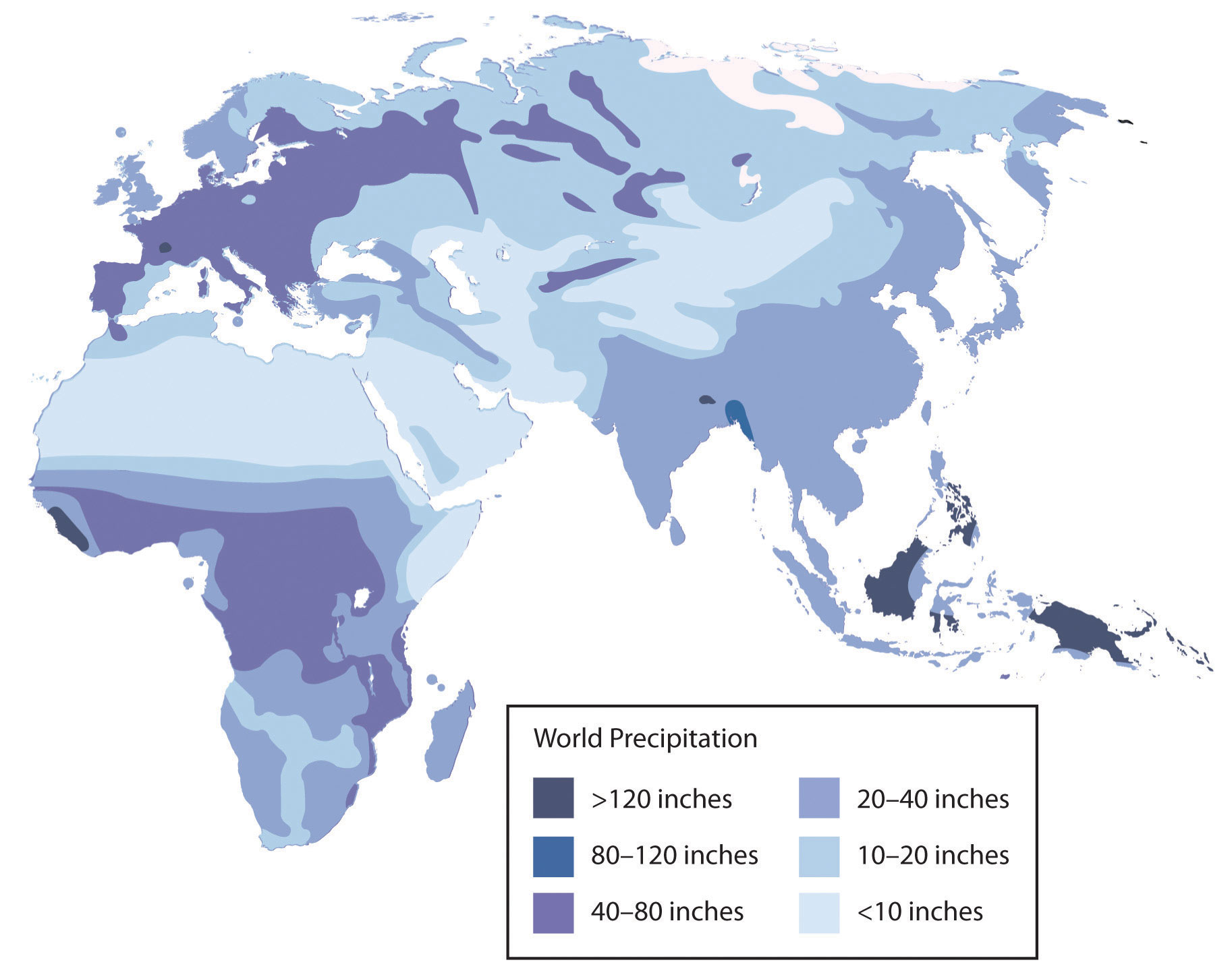
The countries of the realm share some key physical geography traits that influence all other human activities. The first critical common trait relates to the climate of the region. Though various climate types can be found in this realm, it is the dry or arid type B climate that dominates and covers most of the physical area. Other climate types include the type H highland climate (cold temperatures at the high elevations with moderate temperatures at the bases) of the mountains of the Maghreb, Iran, or Central Asia and the more moderate type C climate in the coastal regions bordering the sea. The type C climate along the coastal Mediterranean area attracts human development and is home to many large port cities. The overall fact is that vast areas of each region are an uninhabited desert. North Africa has the largest desert in the world – the Sahara – which borders the Libyan Desert and the Nubian Desert. About one-third of the Arabian Peninsula is part of the Empty Quarter of the Rub’ al Khali (Arabian Desert). Kazakhstan, Uzbekistan, and Turkmenistan have vast regions of the desert with few if any inhabitants. This aspect of the realm reveals the importance of water as a valuable natural resource. Most people in the realm are more dependent on the availability of water than on the availability of oil.
The other factor that all three regions of the realm share are the availability of significant natural resources. North Africa, Southwest Asia, and Turkestan all have significant reserves of oil, natural gas, and essential minerals. It stands to reason that not every country has the same reserves and that some of the countries have very few or none at all. However, in terms of how the countries gain national wealth, it is the export of oil that has dominated the economic activity as it relates to the global community. This realm is a peripheral realm. The resource that the realm can offer to the core economic regions of the world is the energy to fuel their economies and maintain their high standard of living. Enormous economic profits from the sale of these resources have traditionally been held in the hands of the elite ruling leader or his clan and do not always filter down to most of the population. The control of and profits from natural resources have become the primary objectives of the countries; this fuels conflicts and armed military interventions in areas such as Iraq and Afghanistan.
https://www.youtube.com/watch?v=beGNG9X4TBI
Access to Fresh Water
Water is one of the necessities for human existence, and human settlements have long been based on the availability of water for human consumption and agriculture, navigation, and the production of energy. In North Africa and Southwest Asia, the availability of water has an even greater relevance because of the dominant type B climate. Methods used to address the shortage of water or to access fresh water have been nearly as diverse as the people who live here. Large populations of people can be found wherever there is fresh water. Water has historically been transferred from source to destination through canals, aqueducts, or special channels. Many ruins of extensive aqueducts from Roman times and earlier remain throughout the realm. The issues associated with water use continue to affect the lives of the people of this realm. Rapid population growth and industrialization have intensified the demand for fresh water.
Water can be found in the desert regions in a range of forms. For example, there are oases, springs, or noted wells from which people can draw underground water that is close to the surface. Mountainous regions such as the Atlas Mountains in North Africa or the Elburz Mountains in Iran trap moisture, which produces higher quantities of precipitation. The precipitation is then available in the valleys to irrigate crops. Discovering or developing other methods of acquiring fresh water is a requirement in areas without mountains.
Underground Water in Libya
In the Sahara region, Libya draws water from deep underground wells that tap into the vast aquifers beneath the desert that were charged with water when the region was tropical thousands of years ago. The water is referred to as fossil water. Extensive systems of canals and pipelines have been developed in Libya to extract fossil water and use it for agricultural production or urban purposes. The human-made river project, one of the largest of its kind, has drawn fresh water from the desert to large cities such as Tripoli and Benghazi. The local drinking water in Benghazi is contaminated by saltwater intrusion from the Mediterranean. Underground aquifers are underneath political boundaries, so the allocation and control of water are matters of political debate with the potential to lead to military conflict. The project’s potential duration will be a function of how quickly the water is used and how many people use the aquifer system. The main problem with this system is that underground aquifers are not considered a renewable resource; as more countries tap into the aquifers, the available water will be depleted more quickly. As water is drawn from the aquifers for industrial irrigation, the water table goes down. Local settlements that rely on well water may in time have to dig deeper wells or move to locations where water resources are still available.
Nile Water in Egypt
Egypt draws water from the Nile to irrigate fields for extensive food production. For thousands of years, floods of the Nile annually covered the land with fresh silt and water. This made the land productive, but the flooding often caused severe damage to human infrastructure. The building of the Aswan High Dam in the 1970s helped control the flooding of the Nile Valley. The river no longer flooded annually, and water had to be pumped onto the land. Over time, the constant and extensive use of this type of irrigation causes the small quantities of salt in the water to build up in the soil to severe levels, thereby reducing the land’s productivity. This process, called salinization, is a common problem in arid climates. To rid the soil of the salts, fresh water is needed to flood the fields, dissolving the salt and then moving the salty water back off the fields. High salinization in the soil and the reduction in agricultural productivity is a growing concern for Egypt. Egypt’s growing population places a high demand on the availability of food. More than half of the eighty million people in Egypt live in rural areas, and many of them make their living in agriculture, growing food that plays a critical role in the country’s economic stability.
Water from the Tigris and Euphrates
The primary source of water in the Fertile Crescent region comes from the Tigris and Euphrates rivers. Both have their origins in Turkey and converge at the Shatt al-Arab waterway that flows into the Persian Gulf. The Euphrates is the longest river in Southwest Asia and flows through Syria from Turkey before entering into Iraq. Turkey had developed large dams on both the Tigris and Euphrates for agricultural purposes and to generate hydroelectric power. As water is diverted for agriculture in Turkey, there is less water flowing downstream for Syria or Iraq.
Disputes over water resources continue to be a significant concern in the Tigris-Euphrates Basin. The Atatürk Dam in Turkey is the largest dam on the Euphrates, and it has a reservoir behind the dam that is large enough to hold the total annual discharge of the river. All three countries have dams on the Euphrates, and both Turkey and Iraq have dams on the Tigris. The three countries signed a memorandum of understanding in 2009 to strengthen cooperation within the Tigris-Euphrates Basin. All three countries need water for agriculture to produce food for a growing population. Agreements to share water have been challenging as a result of the Iraq War and the recent protests and demonstrations in Syria that have contributed to further political tension between the three countries.
Water Conservation in Israel
Israel has taken innovative steps to conserve water and use it efficiently. Drip irrigation mixed with fertilizers is called fertigation. Fertigation is used extensively in the area. Israel grows plantation crops such as bananas, which require large quantities of water. Banana groves are covered with a material that allows sunlight to penetrate but reduces the amount of transpiration, which conserves water. Israel has worked to recycle water whenever possible. Gray water is water extracted from sewage that has been treated to be used in agriculture. Underground wells in the West Bank region provide water for a high percentage of people in both the Palestinian areas and Israel. The issue of control over the water is contentious at times. Just as the control of water may have been an essential factor in the early Mesopotamian civilizations, it remains a point of political conflict in places such as Israel and the West Bank. The lack of fresh water and the more substantial demand placed on water resources have caused countries that can afford it to desalinize seawater. This process is used extensively in the oil-rich states of the Arabian Peninsula. Israel is implementing a similar plan to accommodate its increasing population and fresh water requirements.
Mountain Water in Iran
Iran is mostly a desert climate; thus, most of the country does not receive copious amounts of precipitation. To redistribute the water available from the high mountains, Iranians have developed a system of qanats to collect water where it is available and channel it to the cities or urban areas for use. A qanat might include a system of shafts or wells along a mountain slope that allows water to collect into a common underground channel, which is then diverted to wherever it is needed. This system has been in use since ancient times in many arid regions of the realm and around the world. More than 2,700 years ago, a qanat was developed in what is present-day Iran. The qanat has a system of hundreds of wells and channels water for more than twenty-eight miles; it still provides drinking water to more than forty thousand people in the city of Gonabad. Thousands of qanats were developed over the centuries in this area. Persians used cold qanat water from the mountains to keep ice cool during the summer months. Agricultural production relies heavily on water from qanats, which in turn are dependent on climate conditions and local weather patterns.
Water Shortages in Arabia
The Arabian Peninsula almost always conjures up images of desert conditions; contrary to that image, there is water in the peninsula. Underground aquifers of fossil water are located beneath the sands similar to that in the Sahara Desert. Saudi Arabia taps into these water resources to irrigate agricultural land to grow food. This area faces the same issue as Libya and other areas of the world that rely on underground aquifers: eventually, the water supply will be used up. The majority of the Arabian Peninsula is desert and water is always in short supply. Many coastal desert countries such as the United Arab Emirates (UAE), Bahrain, and Qatar have resorted to the desalinization of seawater for their needs, but this is viable only as long as the country can afford the energy cost required to operate the desalinization plants.
Yemen is a state on the Arabian Peninsula that is mountainous and has used terracing to more effectively benefit from what little precipitation they receive. Water from precipitation is trapped in terraces, and as it flows down the mountainside, each terrace uses what it needs and then passes the water to the next lower terrace. More extensive ranges of land can be farmed to produce higher yields of crops such as sorghum and cereals. One of the main problems with Yemen’s terrace system is that most of its trees are being cut down for firewood. Tree roots are essential for holding the soil together on the fragile mountain slopes. Another problem is heavy rains that cause severe erosion and damage to the terrace system. Additionally, the extremely rapid growth rate of Yemen’s population is outstripping its agricultural production.
Division of Water in Turkestan
Freshwater is in short supply in many of the desert regions of Turkestan in Central Asia. Agricultural production has traditionally been dependent on water flowing in rivers and streams that originated with the precipitation from the mountains, but as humans have developed canals and irrigation systems, water from rivers has been diverted for agricultural use. Vast fields of cash crops such as cotton were developed during the Soviet era for economic reasons, which helped devastate the depletion of the Aral Sea, which depended on the water from these rivers for its survival. More than half the population of Central Asia depends on agriculture for their livelihood. The other half, of course, requires water and food for their existence.
Aral Sea Environmental Disaster
Uzbekistan and Kazakhstan share central Asia’s shrinking the Aral Sea. The sea was once the fourth-largest body of water in the world, but it has been reduced to a fraction of its original area. In 1960, the Aral Sea covered about 26,254 square miles, an area larger than the size of the US state of West Virginia. By 2009, the sea covered less than 10 percent of the same area. The entire eastern portion of the sea has become a sand desert, complete with the deteriorating hulls of abandoned fishing vessels. The loss of water is approximately equivalent to the complete draining of both Lake Erie and Lake Ontario in North America.
The water loss escalated when the Syr Darya River, which flowed into the northern part of the sea, and the Amu Darya River, which flowed into the southern side of the sea, were diverted for the irrigation of cotton and other crops. At about 1,500 miles long, the Amu Darya is the region’s longest river. Its source is the high mountain streams and lakes of the Pamir Mountains. Environmental problems were further exacerbated by the extensive use of pesticides and fertilizers in agricultural processes. The chemicals contaminated the water flowing into the Aral Sea. Once the water dried up in the sea, the winds carried the buildup of chemicals and salt from the dry seabed over the land, causing serious health-related problems in the nearby human population. Cancer and respiratory illness rates continue to be higher than usual. Water and land pollution is a serious problem. Even the climate around the Aral Sea has changed gradually because of the loss of water from evaporation for precipitation. The climate is getting warmer in the summer and colder in the winter. The moderating effect that this vast body of water had on its surrounding area is no longer as prominent as it once was.
The decline of the Aral Sea has destroyed habitats and the local economy. The fishing industry, which employed more than sixty thousand people, has been devastated. The remaining western portion of the sea has a rising salt content that is contributing to the decline of the fish population. Adding to the environmental devastation, the Soviets conducted biological weapons experiments on an island that was once in the middle of the Aral Sea. Hazardous wastes such as anthrax and toxic chemicals contaminated the land and found their way into the sea. Efforts have been made to marginalize the environmental damage of the contamination, but the damage has not been completely ameliorated. The sea has historically been an essential environmental location for wildlife. It is located in a major flyway for migratory waterfowl in Central Asia and served as essential habitat. The deterioration of the Aral Sea and the destruction of habitat for waterfowl and other organisms is one of the world’s worst environmental catastrophes. The fact that the Aral Sea is located in a region that is not part of the core economic area of the global community has rendered it “out of sight and out of mind” by entities that could potentially provide economic support.
In the northern portion of the Aral Sea, called the Little Aral Sea, there has been some success in abating the deterioration of this once-thriving environmental habitat. A major dam has been constructed that partitions off the Little Aral Sea, causing water from the Syr Darya River to increase the water level of the Little Aral Sea and reduce the salt content. Canals, dikes, and irrigation processes have been updated to reduce the loss of water and increase the amount that flows into the northern section. The development efforts have caused the water level to rise and therefore, have reinvigorated the once-struggling fishing industry. The efforts have been undertaken by Kazakhstan’s government, which controls the Little Aral Sea.
A significant part of the southern portion of the once thriving sea is located in Uzbekistan, which has not contributed the economic attention necessary to halt the sea’s continued deterioration. The remaining western portion of the Uzbekistan side of the Aral Sea will continue to shrink if measures are not taken to address the loss of water from the Amu Darya River. The eastern side was completely dry by 2009. Uzbekistan has responded to the situation by contracting out to various multinational oil companies from Korea, China, and Russia to explore for oil beneath the dry seabed.
The demise of the Aral Sea was caused in part by the diversion of water from its northern inlet, the Syr Darya River. At the other end of the Syr Darya River, an additional factor-augmented the lack of water flow: the Soviet Union placed a dam on the river and allowed the overflow from the dam to flow into low-lying dry pans, creating artificial lakes. As a result, Aydar Lake was created and became the second-largest lake in Uzbekistan. Various species of fish were introduced, and the lake became a significant source for commercial fishing. Hundreds of tons of fish are harvested annually. Just as fishing was declining in the Aral Sea, the fishing industry was growing at Aydar Lake.
